Septic
Triassic Basin Soils and Septic Near Durham
Triassic Basin soils near Durham are clay-rich, wet in winter and often shrink-swell, so many lots struggle to pass a septic soil evaluation and need pressure or engineered designs.
Compiled by the Red Clay Septic & Well desk · Last revised
In these notes
- Where is the Triassic Basin around Durham?
- Why are Triassic Basin soils hard for septic systems?
- Which Triassic Basin soil series show up on Durham lots?
- What does shrink-swell clay do to a drainfield?
- Can you get a septic permit on Triassic Basin soil?
- How do Triassic soils affect wells too?
- Questions worth asking
The short version
- The NC Geological Survey lists Chatham, Durham, Granville and Orange among the 11 counties in the Deep River Triassic basin; Person County is not on that list.
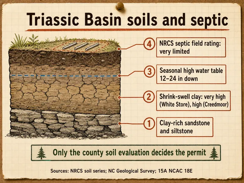
- NRCS rates White Store and Creedmoor soils in Durham County "very limited" for septic absorption fields, citing a shallow saturated zone and slow water movement.
- Both series carry a seasonal high water table 12-24 in below the surface in their NRCS descriptions, and White Store's shrink-swell potential is "very high."
- Under 15A NCAC 18E, expansive clay is unsuitable for a drainfield, and one unsuitable item makes the whole site unsuitable.
- NRCS ratings are planning guides; only the county soil evaluation (or a licensed soil scientist under the private option) decides a permit.
- NC State Extension puts average Triassic Basin well yields at 11-12 gpm, the lowest of the state's Piedmont rock groups.
- 11Counties with part of the Deep River Triassic basinNC Geological Survey
- 12-24 inDepth to seasonal high water table in White Store and Creedmoor soilsNRCS Official Series Descriptions
- 16.3Apparent CEC (cmol/kg) above which a lab calls clay expansive and unsuitable15A NCAC 18E Table VII
- 11-12 gpmAverage well yield in the Triassic basinsNC State Extension
Where is the Triassic Basin around Durham?
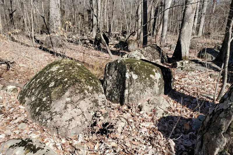
The Triassic Basin runs as a long trough of sedimentary rock through southern Durham County and neighboring parts of Chatham, Orange, Wake and Granville. Geologists call it the Deep River basin, and its northern part is the Durham sub-basin.
The NC Geological Survey says the Deep River basin "includes portions of 11 counties": Anson, Chatham, Durham, Granville, Lee, Montgomery, Moore, Orange, Richmond, Union and Wake. Person County is not among them. The USGS describes the Durham basin as reaching north from the Lee-Chatham line for 83 km through Orange, Wake, Durham and Granville, up to 27 km wide and about 1,700 square km in area. NC State Extension sums up the whole basin as 90 miles long, from central Moore County to southern Granville.
Its edges do not follow roads or subdivision lines. A lot on one side of a creek can sit on Triassic siltstone and the next on granite-derived red clay, so the county soil map for the specific parcel matters more than a regional map.
Why are Triassic Basin soils hard for septic systems?
They are hard because the rock underneath is clay-rich and tight, and the soil formed from it inherits that. The NC Geological Survey says the basin rocks are "very clay rich and poorly sorted," and that "the soil formed from these rocks does not readily transmit or soak up water."
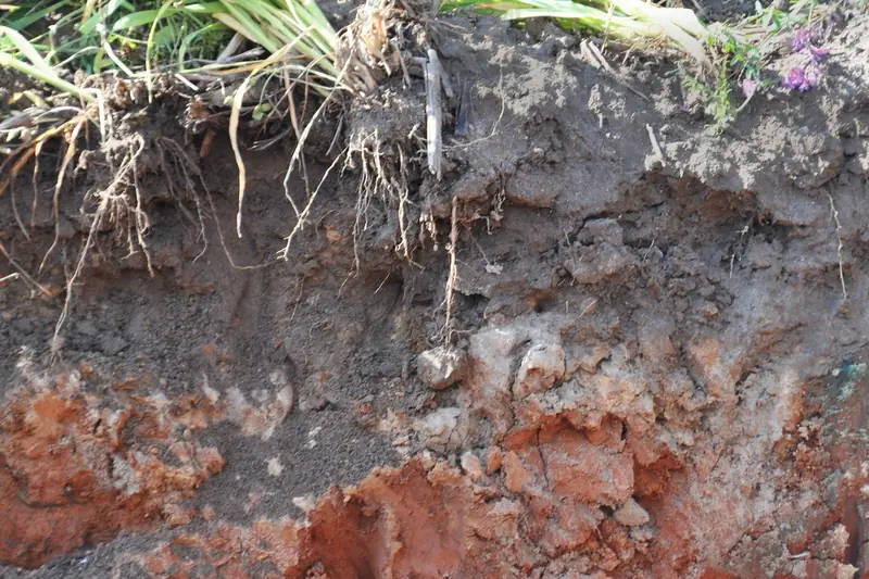
The same agency puts it bluntly: "At many Triassic sites, the soil does not perform adequately during percolation tests for septic drain fields." North Carolina does not actually permit by perc test; it uses a soil and site evaluation under 18E .0501-.0509. Triassic soils tend to fail it for three reasons the evaluator can see in a pit: gray wetness colors close to the surface, slow-moving clay subsoil, and expansive clay that cracks when dry.
The USGS lists the Durham basin rocks as siltstone, sandstone, conglomerate, claystone and shale, cut by diabase dikes and sills of Early Jurassic age. Diabase weathers into its own sticky clays, which adds a second problem soil inside the basin.
Which Triassic Basin soil series show up on Durham lots?
The series that come up most in the basin are White Store, Creedmoor, Mayodan and Pinkston, with Iredell where diabase lies below. Their NRCS descriptions differ enough that the series name on a soil map is a useful first clue.
| Series | Parent rock | Drainage and shrink-swell | NRCS septic field rating, Durham Co. |
|---|---|---|---|
| White Store | Triassic sandstone, mudstone, siltstone or shale | Moderately well drained; very high shrink-swell; water table 12-24 in | Very limited: saturated zone, slow water movement, bedrock |
| Creedmoor | Same Triassic rocks | Moderately well to somewhat poorly drained; high shrink-swell; water table 12-24 in | Very limited: saturated zone, slow water movement |
| Mayodan | Triassic materials | Well drained, moderately permeable, very deep | Mostly somewhat limited (very limited on 15-25% slopes) |
| Pinkston | Triassic sandstone, siltstone, conglomerate | Well or excessively drained; hard bedrock at 20-40 in | Very limited: depth to bedrock, seepage |
| Iredell | Diabase, diorite, gabbro | Moderately well drained, very slowly permeable | Very limited: saturated zone, slow water movement |
Mayodan is the bright spot: the NRCS description calls it very deep and well drained, and its Durham units mostly rate one step better than the others. Pinkston drains well but is too thin over rock. In Chatham County the same survey adds Polkton, Brickhaven and Carbonton, all rated very limited. For contrast, the granite-derived red clays outside the basin are covered on the red clay soil page.
What does shrink-swell clay do to a drainfield?
Shrink-swell clay swells shut when wet and cracks open when dry, so it neither accepts effluent steadily nor treats it reliably. North Carolina rules treat it as a deal-breaker: in 18E Table VI, a moist consistence of very firm or extremely firm, or a wet feel of very sticky or very plastic, marks expansive clay as unsuitable.
When the field test is unclear, a lab can settle it. Table VII rates clay with an apparent cation exchange capacity of 16.3 cmol/kg or less as slightly expansive and suitable, and anything above that as expansive and unsuitable. The White Store description in the NRCS series data notes slickensides, the polished faces left when clay swells and shears, and the Iredell profile reads "very firm, very sticky, very plastic," matching the rule's language almost word for word.
In wet months the swollen clay holds water above it, which is why basin lots so often combine shrink-swell with a high seasonal water table. Effluent that cannot move down moves sideways or up, and that is how a drain field on these soils ends up with soggy ground over the trenches.
Can you get a septic permit on Triassic Basin soil?
Yes, many basin lots are permitted, but the answer depends on the specific pit, not the soil name. Under 18E .0509, any single unsuitable parameter makes the site unsuitable, and no Improvement Permit can be issued for an unsuitable site.
A failing first look is not always final. The rule lets a site be reclassified through site modifications, an interceptor drain, advanced pretreatment, or a system approved under the provisional, innovative and accepted program. Wetness can be re-examined by monitoring or modeling under .0504(c). An owner may also hire a licensed soil scientist under G.S. 130A-335(a2) instead of waiting for the county. If the county says no, 18E .0203(c) requires a signed written report naming the unsuitable features and the rules behind them.
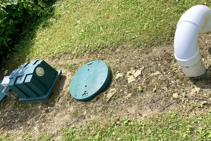
Designs that show up on basin lots include low-pressure pipe, drip dispersal and pretreatment units; see septic system types for what each requires and who must maintain it. Before buying land in the basin, the NC Geological Survey's advice is to make sure of "acceptable water and septic performance." In practice that means an Improvement Permit in hand, or at least a soil evaluation, before closing; the new septic system page walks through the permit steps.
How do Triassic soils affect wells too?
The same tight rock that slows drainfields also holds little water. The NC Geological Survey warns that "water well yields are typically very low, and many dry holes have been drilled," and NC State Extension gives the Triassic basins an average of 11 to 12 gpm, against 18 to 21 gpm for the Piedmont generally.
The USGS treats the Durham, Sanford and Wadesboro basins as too compact and tightly cemented to count as important aquifers. The Survey's practical tip is to look for diabase: the dikes "make good targets for drilling of water wells," and because diabase is magnetic, a geologist may use a magnetic survey to find one.
A lot in the basin therefore has two questions to answer, and the well location and septic field compete for the same ground. Current rules keep a single-family private well 50 ft from the tank and field; older permits may show 100 ft. Well siting and permits are covered under well construction and permits.
Where this comes from
Built from the NC Geological Survey homeowner guide to the Triassic basins, USGS Bulletin 1572, NC State Extension's Piedmont groundwater publication, NRCS Official Series Descriptions, NRCS Soil Data Access septic ratings for the five counties, and 15A NCAC 18E as amended June 1, 2026, all checked October 2026. Not included: drilling cost estimates, contractor opinions on which designs pass, or any claim about a specific parcel. NRCS ratings describe map units, not individual lots.
Questions worth asking
Is all of southern Durham County in the Triassic Basin?
No. The basin is a band, and its edges wander across neighborhoods. NRCS soil maps and NC Geological Survey maps show where Triassic rock and soil series sit, but only a pit on the lot shows what is actually there.
Does Person County have Triassic Basin soils?
The NC Geological Survey's list of Deep River basin counties does not include Person. UNC researchers trace the Carolina Slate Belt into Person County instead, which matters more for well water than for drainfields.
Why do two lots in the same Triassic subdivision get different septic results?
Soils change over short distances; NC State Extension notes a 1-acre lot can hold several soil types. A Mayodan knoll and a White Store slope can sit a few hundred feet apart.
Can a drainfield be put below the shrink-swell layer?
Usually not. The rules measure separation from the trench bottom to any limiting layer, and Triassic subsoils are often clay and wet to depth, with soft bedrock at 40-60 in under White Store.
What is a diabase dike and why does it matter for septic?
It is a narrow, nearly vertical sheet of younger igneous rock cutting through the Triassic beds. It helps well drillers, but it weathers into Iredell-type clays that rate very limited for septic.
Does a "very limited" NRCS rating mean the county will deny a permit?
No. It flags likely problems for planning. The county's soil evaluation under 18E decides, lot by lot, and a map unit is drawn at a scale far coarser than one drainfield.
Read next
Filed under Septic notes · the front page of these Piedmont field notes